Intelligent Vision Systems Lab
Extracting useful information using sophisticated imaging systems
We specialize in 3-D Reconstruction, Convolutional Neural Networks and Machine Learning, Object Recognition, Virtual Reality, Augmented Reality, Image Processing, Photogrammetry and Camera Calibration. The IVS Lab is known for providing vision-based solutions for businesses, innovators and entrepreneurs across New Zealand and the world. Established in 2005, with over 1000 publications, the IVS Lab is a leading authority in the field of Computer Vision. The current focus of the group is to combine hardware, algorithms and machine learning to form useful systems that can measure the geometry, topography and the composition of scenes at various scales and resolutions.
For our previous website please go here.
Research Themes

Assembly of bespoke hardware and software configurations to solve specific scene measurement problems: We have developed systems for LIDAR calibration, Smartphones, Raspberry Pi, NVidia Jetson, Kinect, Asus Xtion, GoPro Cameras and many more. We specialise in combining multiple cameras and sensors to acquire optimal results through sensor consistency.
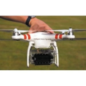
Processing Image captures from Aerial Vehicles: UAV (unmanned aerial vehicles) are extremely useful at collecting data from unique vantage points. The IVS lab has worked on several projects acquiring 3-D maps from scenes, recognizing objects in aerial images and a unique multi-scale solution that allows high-levels of detail to be inferred from low resolution high-altitude footage.
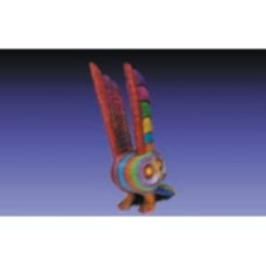
Low cost 3D scanning and object reconstruction systems: 3-D models are in high demand for computer graphics, virtual reality (VR), augmented reality (AR) and 3-D printing. Commercial 3D scanners tend to be both expensive and limited. We have developed a turntable system and a handheld stereo camera system that are cheap to assemble and perform robust 3-D scanning.
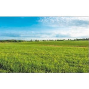
Pasture Management: In 2016, the IVS Lab’s Pasture Dry matter measurement system (ThinkPasture) was a finalist in the Velocity $100K Challenge (The University of Auckland’s premier annual entrepreneurship contest). This award winning system allows for effective management of pastures leading to significant gains for dairy farmers.
Team
The Intelligent Vision Systems Laboratory (IVS Lab) is a group of researchers whose members include leading experts in the field of Computer Vision (algorithms and processes that allow computers to construct highly detailed digital models of scenes depicted in images or video sequences)
The IVS Lab operates within the University of Auckland (New Zealand’s top university according to the QS World Rankings) and is currently headed by Associate Professor Patrice Delmas.

Patrice Delmas
Associate Professor
completed his MEng, MSc and PhD degrees, in 1994, 1995 and 2000, at the National Polytechnic Institute, Grenoble, France. He has been with the Department of Computer Science at the University of Auckland
since 2001 and is currently an Associate Professor.

Georgy Gimel’farb
Professor Emeritus
completed his MSc with high honours in 1962 at the Kiev Polytechnic Institute, and his Ph.D. in 1969 at the Institute of Cybernetics (Ukraine). He has lectured at the University of Auckland since 1997. While he has retired, he is still active within the IVS Lab on a part-time basis.
Contact – Access
Visitors must check in with:
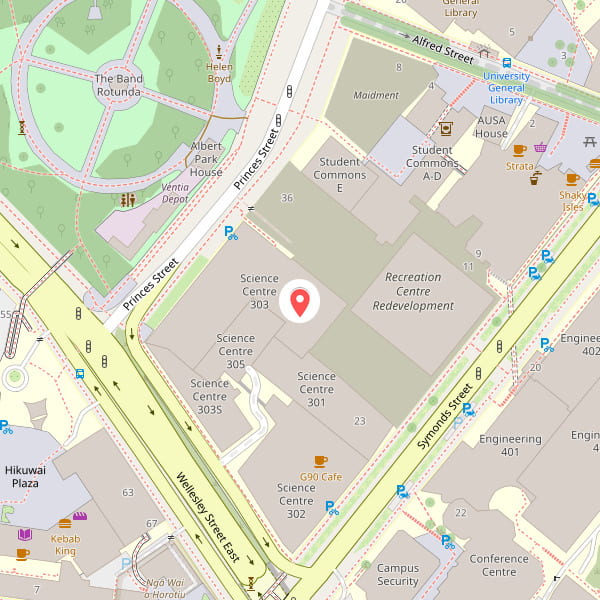
Assoc. Prof. Patrice Delmas at office 303S-391
Intelligent Vision System research lab, Building 301
Level 4, Room 407
School of Computer Science
Science Building, the University of Auckland
38 Princes Street, 1010 Auckland, New Zealand.

Publications
Wang, J., Gong, R., Heidari, S., Rogers, M., Tani, T., Abe, H., Ichinohe, N., Woodward, A., Delmas, P. (2024). A Deep Learning-Based Pipeline for Segmenting the Cerebral Cortex Laminar Structure in Histology Images. To appear in Neuroinformatics.
Rogers, M., Blanc-Talon, J., Urschler, M., Delmas, P. (2023). Wavelength and texture feature selection for hyperspectral imaging: a systematic literature review, Journal of Food Measurement and Characterization, pp. 1-26, 2023.
Rogers, M., Gendron, G., Soriano Valdez, D., Azhar, M., Chen, Y., Heidari, S. …, Delmas, P. (2023). Meerkat Behaviour Recognition Dataset, arXiv preprint arXiv:2306.11326.
Schenone, S., Azhar, M., Delmas, P., Thrush, SF., (2023). Towards time and cost‐efficient habitat assessment: Challenges and opportunities for benthic ecology and management. Aquatic Conservation: Marine and Freshwater Ecosystems.
Heidari, S., Dinneen, MJ., Delmas, P. (2023). An Equivalent QUBO Model to the Minimum Multi-Way Cut Problem. International Journal of unconventional computing 18(1):93-113, OLD CITY PUBLISHING INC.
Liu, N., Rogers, M., Cui, H., Liu, W., Li, X., Delmas, P. (2021). Deep convolutional neural networks for regular texture recognition. PeerJ Computer Science 8:e869.
Schenone, S., Azhar, M., Ramírez, C. A. V., Strozzi, A. G., Delmas, P., & Thrush, S. F. (2021). Mapping the Delivery of Ecological Functions Combining Field Collected Data and Unmanned Aerial Vehicles (UAVs). Ecosystems, 1-12.
Azhar, M., Schenone, S., Anderson, A., Gee, T., Cooper, J., van der Mark, W., … Delmas, P. (2020). A framework for multiscale intertidal sandflat mapping: A case study in the Whangateau estuary. ISPRS Journal of Photogrammetry and Remote Sensing, 169, 242-252.
Bertin, S. P., Levy, B., Gee, T., Delmas, P. (2020). Geomorphic change detection using cost-effective structure-from-motion photogrammetry: evaluation of direct georeferencing from consumer-grade UAS at Orewa beach (New Zealand). In Photogrammetric Engineering and Remote Sensing journal (PERS), 86(5): 289-298.
Gee, T., Delmas, P. (2019). Visual Odometry in Moving Urban Environments. Accepted for publication in Integrated Computer-Aided Engineering Journal. Impact factor: 3.667.
Duwig, C., Prado, B., Tinet, AJ., Delmas, P., Dal Ferro, N., Vandervaere, JP., Morari, F. (2019) Impacts of land use on hydrodynamic properties and pore architecture of volcanic soils from the Mexican Highlands. Soil Research, 57(6), 629-641.
Azhar, M., Chang, X., Debes, J., Delmas, P., Duwig, C., Dal Ferro, N., Muller, K. (2019). Advantages of multi-region kriging over bi-region techniques for computed tomography-scan segmentation. Soil Research, 57 (6), 521-534.
Bertin, S., Friedrich, H., & Delmas, P. (2016). A Merging Solution for Close-Range DEMs to Optimize Surface Coverage and Measurement Resolution. Photogrammetric Engineering & Remote Sensing, 82 (1), 31-40.
Liu, N., Gimel’Farb, G., & Delmas, P. (2016). Learnable high-order MGRF models for contrast-invariant texture recognition. Computer Vision and Image Understanding, 143, 135-146. Impact Factor: 1.540.
Peng, Z., Duwig, C., Delmas, P., Gaudet, J. P., Gastelum Strozzi, A., Charrier, P., Denis, H. (2016). Visualization and Characterization of Heterogeneous Water Flow in Double-Porosity Media by Means of X-ray Computed Tomography. Transport in Porous Media, 110(3), 543-564. Impact Factor: 1.540.
Bertin, S., Friedrich, H., Delmas, P., Chan, E., Gimel’farb, G. (2016). Digital stereo photogrammetry for grain-scale monitoring of fluvial surfaces: Error evaluation and workflow optimisation. ISPRS Journal of Photogrammetry and Remote Sensing, 101, 193-208. Impact factor: 3.132.
Bertin, S., Friedrich, H., Delmas, P., Chan, E., & Gimel’farb, G. (2014). Dem quality assessment with a 3d printed gravel bed applied to stereo photogrammetry. The Photogrammetric Record, 29(146), 241-264.
